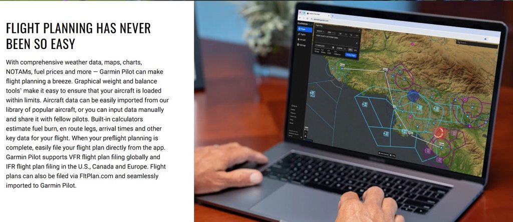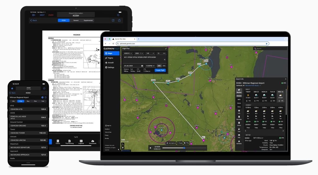
Anyone use a Garmin product? Let's fly along with Garmin Pilot app product manager Stevie in her Bonanza

BFaucett

AH enthusiast
Joined
Apr 13, 2025
Messages
310
Reaction score
1,391
Location
Houston, Texas
Media
2
Articles
1
Hunted
Limpopo RSA (3x), Texas
Anyone here use a Garmin product? I don't know if this well generate any interest on here but I thought I'd take a chance and post it. Hopefully, some here might find it to be interesting. BTW, I'm not a pilot but I've always had an interest in and a fascination with aviation. I hope some here will enjoy this.

I knew from a few previous videos of hers, that Stevie is a product manager at Garmin. She just never gave much details about it (IIRC). In this video, she mentions that she's the product manager for the Garmin Pilot app and she talks a little about her job. Pretty dang impressive, IMO! (y)

So, let's fly along with Stevie as she goes to work.

Cheers! Bob :)


fly to work with me! product manager in tech | california to arizona
video posted to YouTube on May 17, 2026

description: "Today we're flying the Bonanza from California to Arizona for a week in the office at Garmin!"

YouTube channel: Stevie Triesenberg

Stevie Triesenberg's personal aircraft:
1949 Cessna 140A (N9477A)
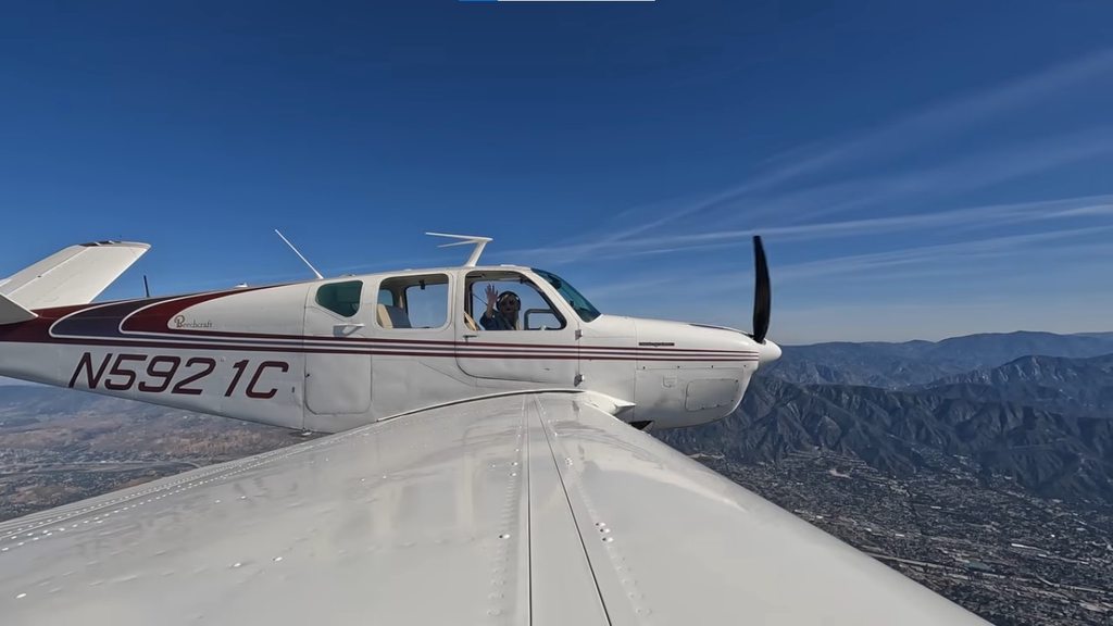
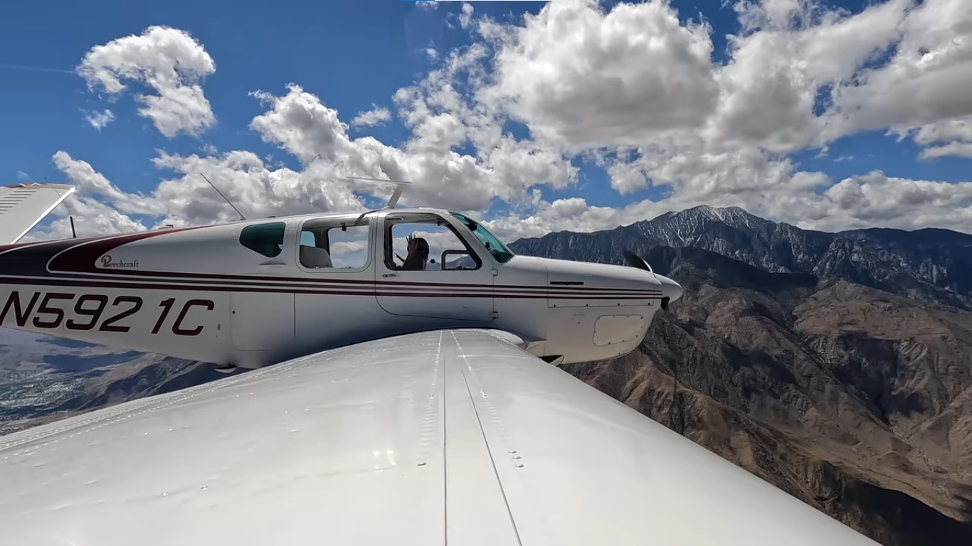
1952 Beechcraft Bonanza C35 (N5921C)

Just as some of us here like classic firearms, Stevie really likes classic general aviation aircraft. :)


----------------------------------------------
Part 2

And the return flight back to home...


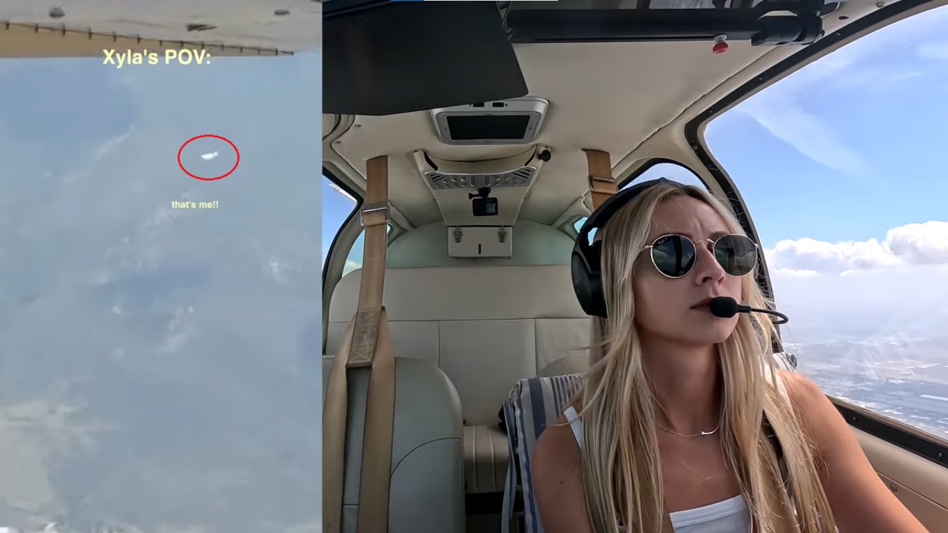
When she uploaded this video, Stevie apparently forget to allow playback on other websites. :( (It's happened a few times before.) Just click on the "Watch on YouTube" link below to watch the video. Stevie does talk about her job at Garmin a little more in this video if you're interested in that. She also happens to fly past her friend and fellow YouTuber Xyla Foxlin in her 1946 Cessna 140. Stevie also owns a 1949 Cessna 140A. Kinda neat.



fly home with me after a week at the office | arizona to california
video posted to YouTube on May 31, 2026

Click on the "Watch on YouTube" link above.

description: "Today we're flying the Bonanza back home from Arizona to California after a week in the office at Garmin!"

YouTube channel: Stevie Triesenberg
1952 Beechcraft Bonanza C35 (N5921C)


sddefault.jpg

Xyla Foxlin with her 1946 Cessna 140.

Xyla's YouTube channel: https://www.youtube.com/@xylafoxlin/videos
 
We have Garmin units on our sportfishing vessel. Garmin has made leaps and bounds in their products for the last decade. IMO, they own the recreational side of the marine market now. It had been dominated by Furuno, Simrad, and Raymarine. Raymarine fell way behind. Simrad has been known to have quality issues. Furuno makes some insanely good stuff but it's expensive and very challenging to operate and get used to. Garmin is taking monster bites out of the market. Good quality, decent price, and easy to use.

Their stuff has some wild capabilities now. I know their plotters will link to the smartwatches and you can change the course of the autopilot remotely, from lets say, the back of the vessel.
 
Last edited:
I’ve been researching handheld GPS lately for something more accurate than a smartphone. One second accuracy is plus or minus about 80 feet. I am wanting something under 10 feet accuracy for property line clearing.

Any suggestions?
 
Well, I think they say 80' +/- for liability reasons. The new stuff is absolute dead on.

I can tell you on our marine unit, the pin on the chart is exactly where the vessel is on the dock. If we were off by 80', it would be clear on the chart. It probably shows it within 3-4' of where it actually is.

By the way, from what I've been told, your position will be almost exactly correct. The issue is how it extrapolates visibly on the chart you are referencing. Don't know if that makes sense or not.

As far as will that hold up in a court of law? Tough to say.
 
Open the compass / GPS app on your phone. It will read the point as degrees minutes seconds. You can move a significant distance in any direction and the reading won’t change. Unless you have accuracy down to decimal seconds, you have plus or minus 80 feet.
 
Open the compass / GPS app on your phone. It will read the point as degrees minutes seconds. You can move a significant distance in any direction and the reading won’t change. Unless you have accuracy down to decimal seconds, you have plus or minus 80 feet.

You're probably into expensive surveying equipment at that point.

Something like this:


Being that a good handheld GPS is probably $300-$400 anyway that's not too bad of an upcharge.
 
Not much interest in Garmin aviation stuff but that gal sure got my attention! Everyone talking way too fast for me to follow what's being said. Very poor articulation. Especially that guy in the tower. Seems to me that should be safety concern.
 
Not much interest in Garmin aviation stuff but that gal sure got my attention! Everyone talking way too fast for me to follow what's being said. Very poor articulation. Especially that guy in the tower. Seems to me that should be safety concern.

Yeah, Stevie is a cutie. I hope you enjoyed the videos. It's takes practice listening to the comms on the radio.

Cheers! Bob F.
 
I use Garmin marine and firearm chronograph equipment.
 
Do I use Garmin products…..

Garmin Fenix 6 watch- all day, everyday
Garmin Inreach - carry and use for texting around the world.
Garmin Drivesmart 61- For street driving because my pickup does not have a GPS.
Garmin 696- I used it for navigation in Antarctica for 10 months.
 
Is this Garmin program designed to compete with ForeFlight?

Hmmm... good question! Since I'm NOT a pilot (just an old guy that enjoys aviation "stuff"), I don't really know for sure. As such, I turned to Google AI and, FWIW, here's the result:

Does garmin pilot compete with foreflight?​
Answer:​
Yes, Garmin Pilot directly competes with ForeFlight as a top-tier Electronic Flight Bag (EFB) app, with both offering comprehensive preflight planning, in-flight navigation, and chart display. While ForeFlight is considered the industry standard with a more intuitive interface, Garmin Pilot offers superior, seamless integration with Garmin avionics, making it the preferred choice for pilots with Garmin-equipped panels.​
Key Competition Factors:​
  • Integration: Garmin Pilot excels if you fly with Garmin avionics (G1000, GTN, etc.), allowing for deep, native integration.
  • User Interface: ForeFlight is generally considered more intuitive, user-friendly, and has a higher adoption rate among flight schools.
  • Features: Both apps feature powerful in-flight navigation, but they differ in, for instance, Garmin's SmartCharts, which offer interactive, data-driven, chart-free IFR navigation.
  • Platforms: ForeFlight is exclusively for Apple iOS, while Garmin Pilot supports both iOS and Android, which is a major differentiator.
I follow a few different private pilots on YouTube and most of them use Garmin panels/avionics in their planes. Besides Stevie, I'm not sure if they also use the Garmin Pilot app as I don't recall most of them specifically mentioning it.

I hope this was a little helpful but, heck, at least you now know the identity of the Product Manager of Garmin Pilot! :cool:

BTW, below is another video that I thought some here might enjoy although there's no mention, as I recall at the moment, of the specific avionics being used.

Cheers! Bob F. :)


Just for fun:

A Flight That Didn't Go as Planned | The Weather Kept Getting Worse
video posted to YouTube on Jun 3, 2026

A routine flight that went south quickly. What started as a fun flight to Sedona with fellow pilot and creator @kinsey22 quickly turned into one of the more challenging weather flights I've experienced in a long time. The forecast looked manageable. Reality was something else.​
Throughout the trip, we found ourselves navigating around thunderstorms, flying through clouds and IMC (Instrument Meteorological Conditions), flying through icing conditions, dealing with rapidly changing weather and battling winds gusting upwards of 45-knots. As the day went on, the weather kept getting worse.​
This was about constant decision-making, risk management, staying ahead of the airplane and knowing when to change the plan.​

YouTube channel: Stephanie Goetz

Stephanie Goetz
ATP (Airline Transport Pilot) rated pilot, CFI (certified flight instructor), and MEI (multi-engine instructor) with 5 jet type ratings. Flies the Aero L-39C Albatros, Bombardier Global 6000, Cessna Citation V, and a Van's Aircraft RV-4.​
Personal aircraft:​
1974 Aero L-39C Albatros (NX339SG)​
1992 Cessna Citation V (N555EH)​
2002 Van's Aircraft RV-4 (N678EH)​

Kinsey Wolanski
Instrument rated private pilot. Rotary (helicopter) pilot rating.​
Personal aircraft: 1985 Beechcraft Bonanza B36TC [turbo] (N36TK)​
YouTube channel: Kinsey
 

Forum statistics

Threads
68,781
Messages
1,530,944
Members
157,060
Latest member
BobbySolve


Latest posts

Latest profile posts

Enjoying hunting in the Kalahari with good FREIND Brendan HTK safaris
Stnelson wrote on Never Been's profile.
I want one of the stocks.
buckstix wrote on 450 Dakota's profile.
SENT THIS PM YESTERDAY ..

I will take a set .. I would take more than one set if you have more.

BUCK STIX - [redacted]
 
Top